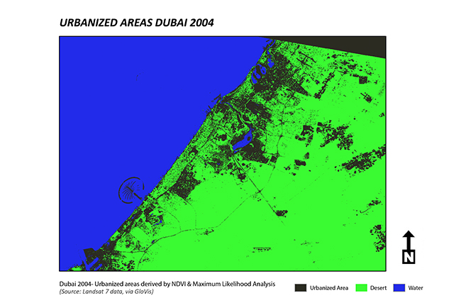
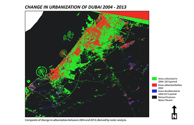
MUSA ‘14 alum, Shrobona Karkun’s map presentation, “Application in Urban Spatial Analysis: Mapping Urbanization in Dubai,” was selected for publication in Esri Map Book, Volume 30, which will be distributed at the 2015 ESRI International User Conference. Karkun’s maps demonstrate an analysis of aerial imagery using open source remote sensing data to evaluate the change in urbanization in the Emirate of Dubai between 2004 and 2013. This map presentation was completed as part of coursework for a MUSA course in advanced GIS methods, taught by Ken Steif.


Megan Schmidgal
Communications & Publications Director
215-573-8386
megands@upenn.edu
You might also be interested in...
Don’t miss the latest from Penn IUR. Subscribe to Urban Link.
Providing expert commentary on urban topics and highlighting Penn IUR's research in the context of pressing urban issues.

